Documentation
How to use InfractusGPS with confidence.
A clear guide for setup, navigation, tracking, and data management on your Android device. Includes detailed usage for the app's primary pages: Home, Log, Waypoints, GNSS, and More.
Quick Start
Install from Google Play, grant location and storage permissions, then open the app. Use the bottom navigation to jump between Home, Log, Waypoints, GNSS, and More.
- 1. Download InfractusGPS.
- 2. Allow GPS and storage permissions.
- 3. Start tracking your first route.
Key Features
Know where you are. Find what's next.
View your position
See current latitude/longitude, altitude, speed, heading, and accuracy; share your position with others.
Track your routes
Record your path and progress. Export your journey for analysis.
Find your waypoints
Save and organize waypoints, share your waypoints with others, and use the Find feature for directional guidance to a selected waypoint.
View GNSS data
Inspect satellite counts, satellites in use, and detailed satellite metrics including signal strength and azimuth/elevation.
Permissions & privacy
Grant only the permissions the app requests for navigation and local data storage. Location data is used to provide the tracking experience and is stored locally unless exported.
Field operation tips
For best results, enable high accuracy mode and keep the device outdoors when collecting fixes.
Localizations
InfractusGPS is available in: English, German, Spanish, French, Hindi, Indonesian, Japanese, and Portuguese (Brazil).
Detailed instructions
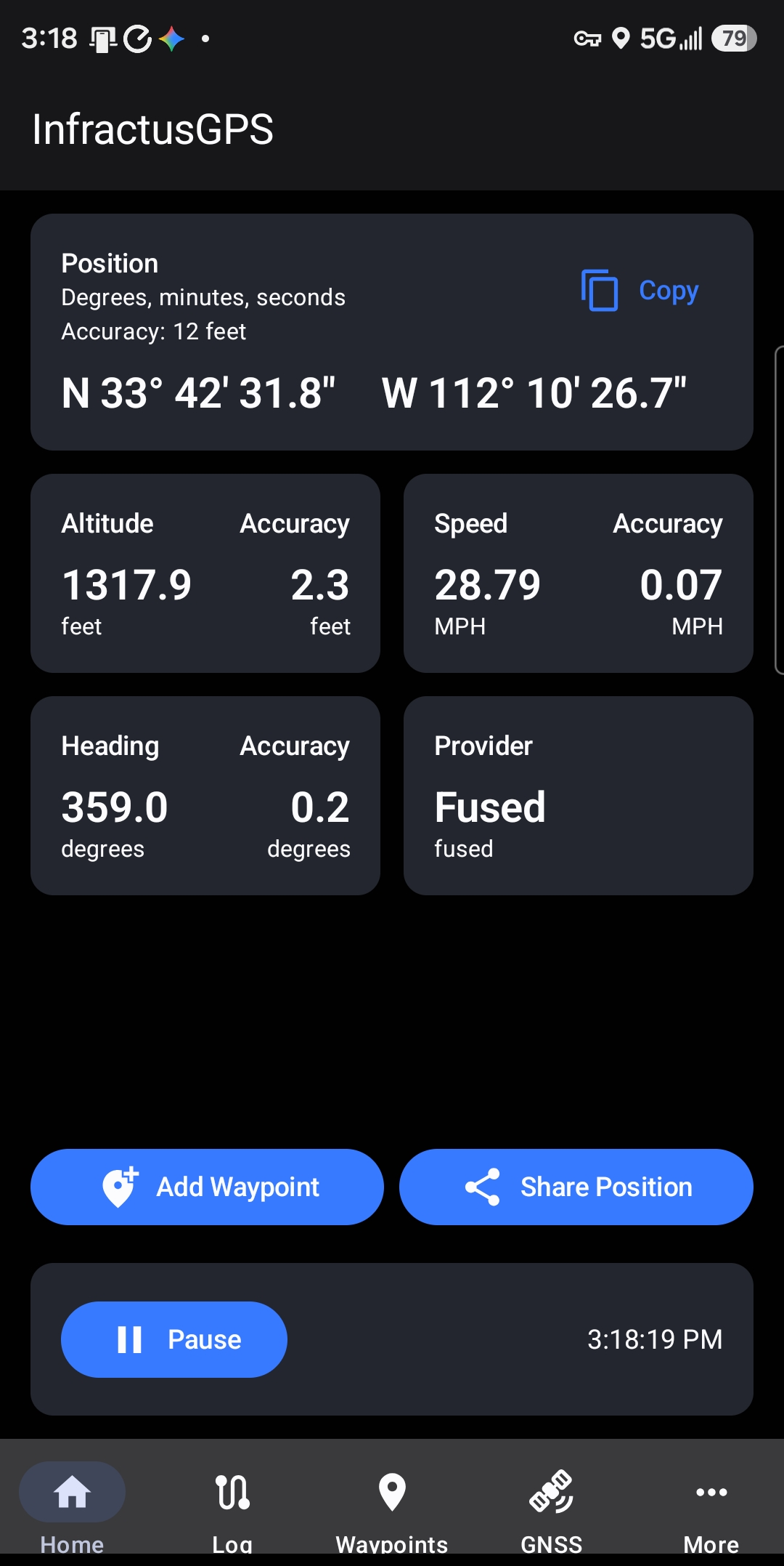
The Home page displays the current position information including the active position, altitude, speed, heading, provider, and expected accuracy. The provider card toggles between Fused and GNSS sources. Tap the position card to cycle formats: degrees/minutes/seconds, degrees/minutes, or decimal degrees.
Use Add Waypoint to save the current location; the app suggests a default name, but you can overwrite it with any unique waypoint name.
Use Share Position to send the current location as a Google Maps link through any share-capable app.
Select Pause to freeze the current position state, then Resume to return to live updates.
The Log page captures your position over time and shows the number of samples recorded, the maximum buffer capacity, and the current buffer usage percentage. The initial button says Start; starting a new log clears any existing data and begins capturing position fixes.
The app only records a fix if position data is available and the device has moved beyond the configured delta distance threshold. While logging, the notification shade displays recording status and allows you to pause or stop position logging.
After at least one sample is recorded, use Share CSV to export a comma-separated spreadsheet file or Share GPX to export a standard GPS Exchange Format file for mapping applications. GPX files can be loaded into various tools to display your route. www.viewgpx.com is a free, online app that displays GPX files.

Initial state

Recording in progress

Paused recording

Notification shade status
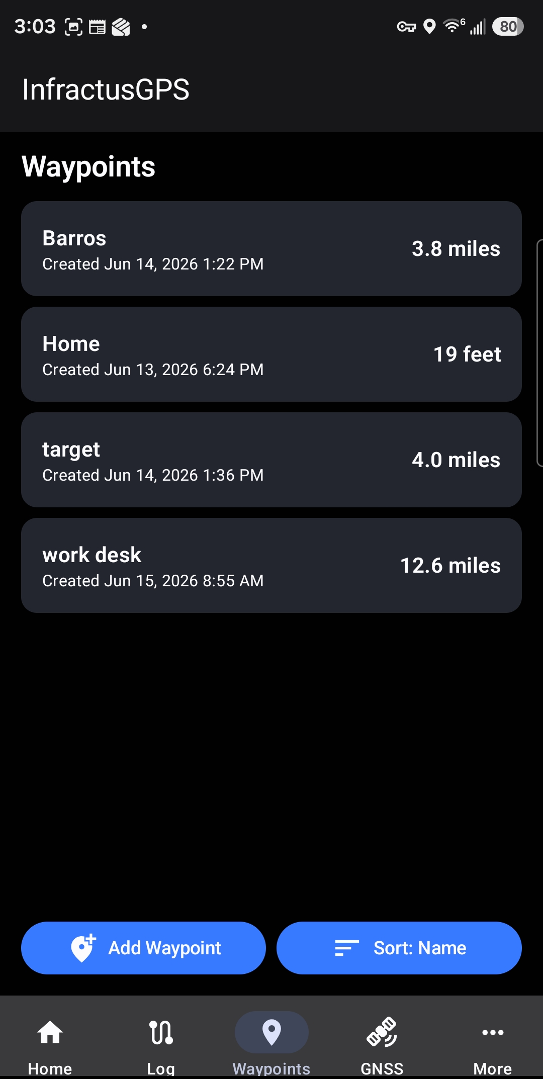
The Waypoints page lists saved waypoints, including name, creation timestamp, and distance from the current location. Use the Sort button to cycle through sorting by name, distance, or creation time.
Select Add Waypoint to create a new waypoint by entering or pasting coordinates. The app parses most common coordinate formats so adding a location from another source is easy.
Tap any waypoint in the list to open the Waypoint Detail page.
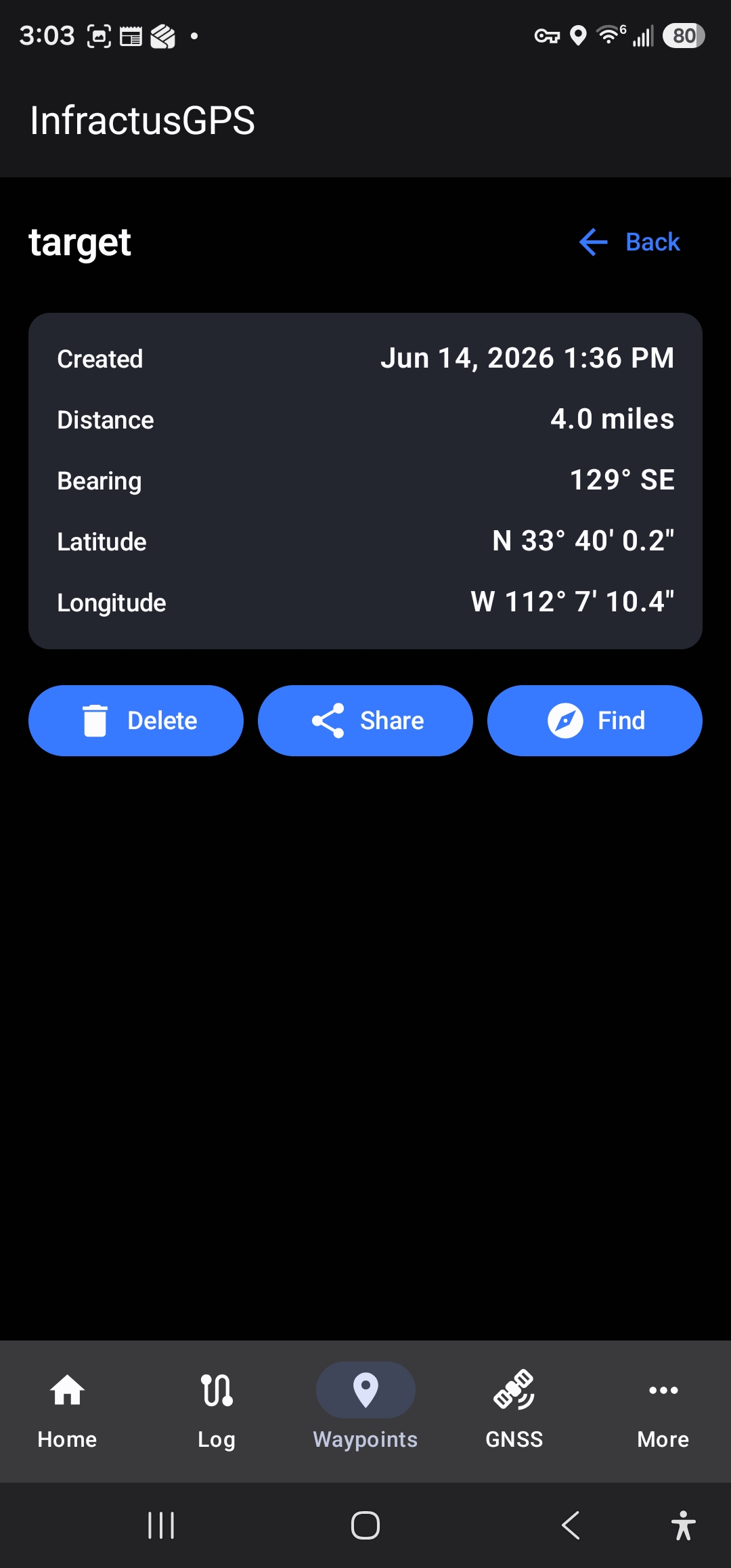
The Waypoint Detail page shows the waypoint name, creation date and time, latitude and longitude, and the distance and bearing from your current position.
Use Delete to remove the waypoint.
Select Share to send a Google Maps link to the waypoint through a shareable app.
Find opens the Find page and starts directional guidance toward the selected waypoint.
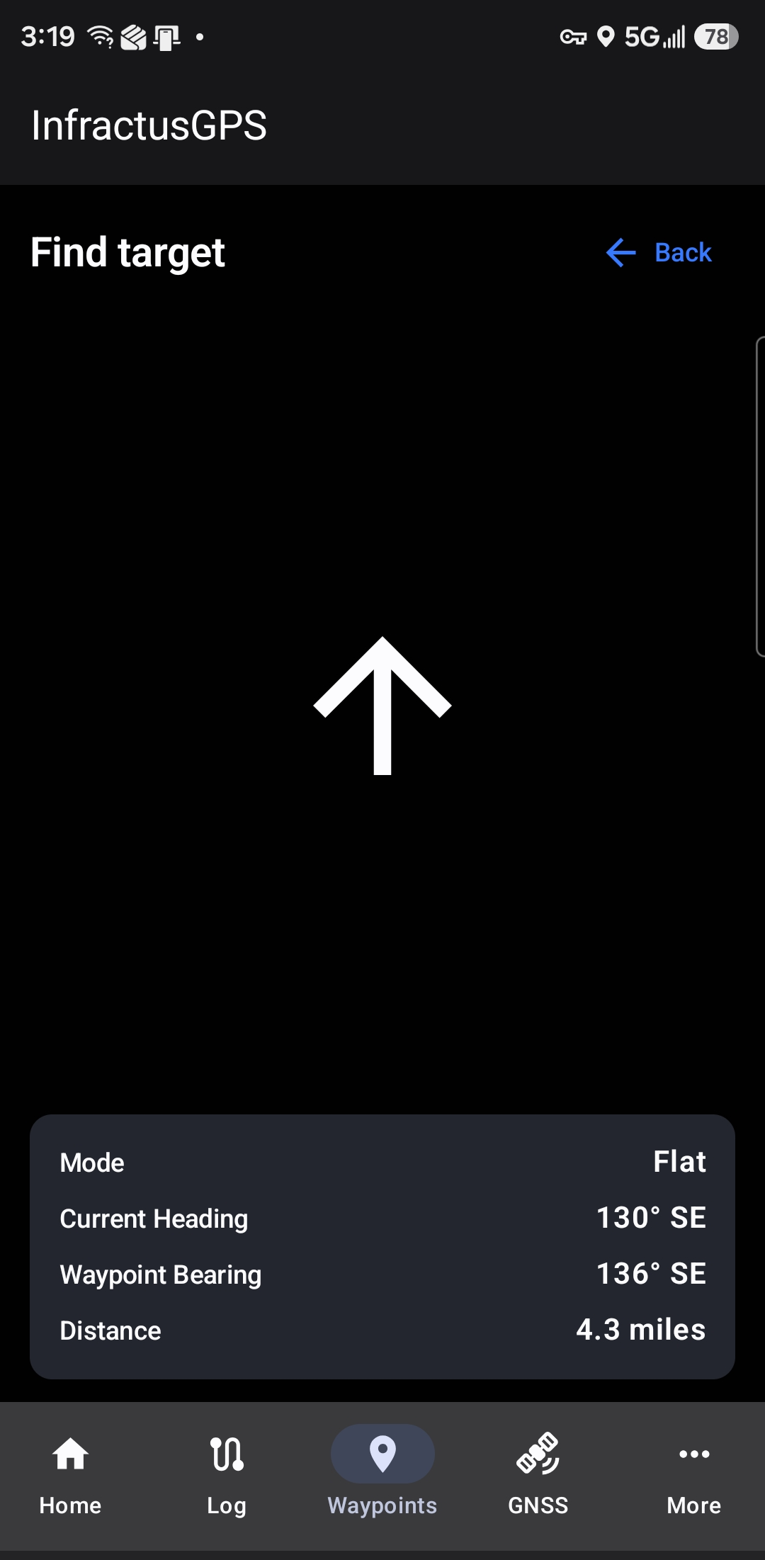
The Find page displays the selected waypoint name and a directional indicator showing the relative direction to the waypoint, based on current heading and device orientation. The page also shows the current heading, the bearing to the waypoint, and the remaining distance.
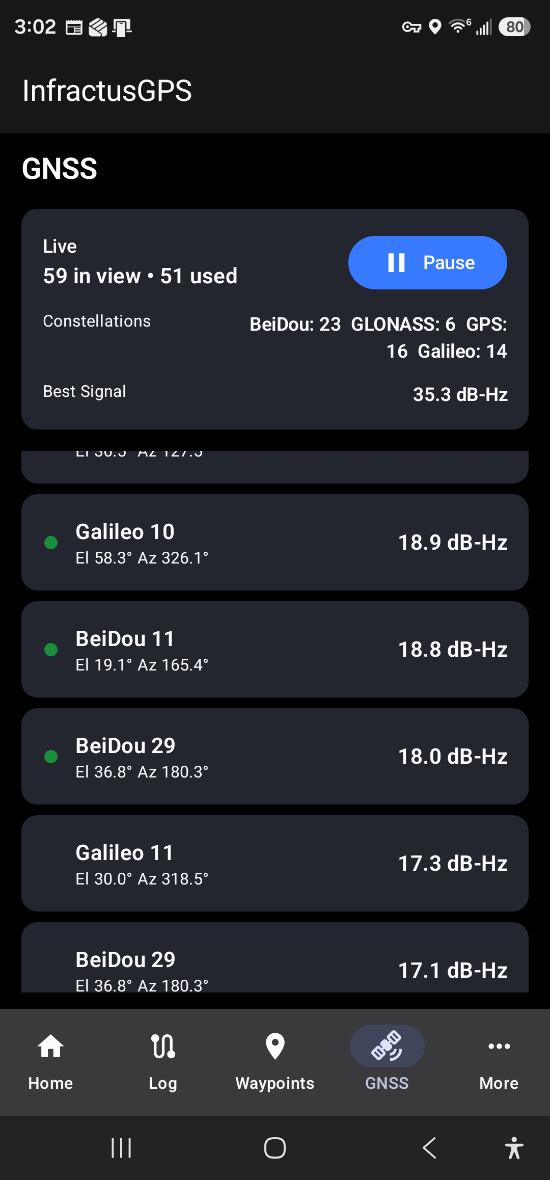
The GNSS page provides a summary of satellite state, including satellites in view, satellites used for the current position, and counts by constellation such as GPS, GLONASS, BeiDou, and Galileo. The page also lists individual satellites sorted by signal strength.
Select a satellite to view the Satellite Details page. Use Pause to freeze the displayed GNSS state.
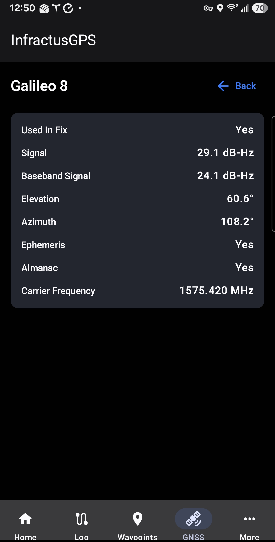
The Satellite Details page displays information for a selected satellite, including its name and constellation, signal strength, carrier frequency, elevation, azimuth, and whether ephemeris and almanac data have been captured.
This page is accessed by selecting any satellite from the GNSS page.
The More page provides access to the Settings page and the About page. It is the gateway to app configuration and general application information.

The Settings page is divided into General, Logging, and Privacy sections.
General settings let you choose imperial or metric units, default coordinate format, and default location source (Fused or GNSS).
Logging settings control the capture frequency, delta position threshold, buffer size, and buffer-full behavior (Stop Recording, Wrap Around, or Restart).
Privacy settings include the ability to delete all stored waypoints and logs.

The About page displays general app information, including the app name, developer details, and build or version information. It also references privacy and usage details for the app.
